Publications
1-7 of 7
-
Road Safety Data
Improving Road Traffic Injury Statistics in Low- and Middle-Income Countries
November 2023
- National decision-makers recognize the issue of underreporting but tend to dismiss higher estimates by global statistical models.
- Most countries use WHO GSRRS estimates.
- National health surveys and censuses in LMICs often contain relevant information, and minor modifications can greatly improve their usage for such measurements.
- Incorporating national health survey data into global statistical models can help resolve discrepancies and increase confidence in estimates.
- Integrating epidemiological data sources into global statistical models (GBD, GHE, GSRRS) to reduce discrepancies and increase confidence in their estimates.
- Including relevant questions in upcoming national data collections to facilitate epidemiological measurements of road traffic injuries.
- Encouraging local involvement in data production for better estimates.
- Enhancing coordination between the Institute for Health Metrics and Evaluation and the World Health Organization to improve estimates and reduce inconsistencies.
-
-
Road Safety Data
Directrices Para la Realización de Evaluaciones de Datos de Seguridad Vial (Spanish)
July 2022
-
Road Safety Data
Guide pour la Conduite de Revues de Données de Sécurité Routière (French)
July 2022
-
-
Road Safety Data
DRIVER: The World Bank’s Sustainable Solution for Road Crash Data Management
March 2018
Road safety is a global health and economic issue that disproportionately affects low- and middle-income countries (LMICs). Precise data is crucial for understanding the full scope of the problem and developing effective interventions, but LMICs struggle to collect comprehensive data due to limited resources, underdeveloped health systems, and inconsistent data collection processes.
To overcome reporting gaps, three major global statistical models are utilized: The Institute for Health Metrics and Evaluation Global Burden of Disease (GBD) study, the World Health Organization (WHO) Global Status Reports on Road Safety (GSRRS), and WHO Global Health Estimates (GHE). However, discrepancies exist among these models and between them and official country statistics. They often estimate significantly higher road traffic fatalities and injuries than official LMIC statistics.
This GRSF study identifies the reasons behind statistical discrepancies and outlines strategies to strengthen modeling efforts. This involved qualitative research, a systematic review of national data availability, and four case studies in Brazil, Cambodia, Ethiopia, and Tanzania.
Key findings include:
Recommendations include:
To achieve the goal of the Second United Nations Decade of Action for Road Safety (reducing road traffic fatalities and injuries by 50% by 2030), substantial resources need to be allocated to road safety and accurate reporting and statistical estimates are required.
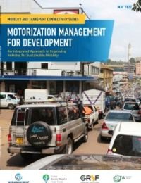
Across the developing world, countries are experiencing rapid growth in urbanization and motorization. While high motorization rates potentially meant hat more people will be able to claim the benefits of improved accessibility to goods and services as a consequence of enhanced mobility, there are questions about the sustainability of this future. Will countries be able to build and maintain infrastructure to accommodate increasing numbers of vehicles? Will the increasing number of vehicles and their characteristics support attainment of the Sustainable Development Goals (SDGs) Will they put in jeopardy countries’ ability to meet their climate commitments under their Nationally Determined Contributions (NDCs)? From a development impact standpoint, the nature of a country’s motor vehicle stock and how it grows affects three key and tangible outcomes.
First, the quality of the motor vehicle stock affects road safety outcomes—that is, the number of people killed or seriously injured in motor vehicle crashes. The characteristics of vehicles and their fitness or roadworthiness can affect fatality and serious injury outcomes. Second, the quality of the motor vehicle fleet affects air quality, particularly in cities. Motor vehicles are a key source of harmful air pollution, including carbon monoxide (CO), fine particulates (PM2.5), sulfur oxides (SOx), and ozone precursors (oxides of nitrogen and various hydrocarbons), and the amount of these pollutants they emit is directly related to how the vehicle was built and how well it is maintained. Finally, the profile of the vehicle fleet—what is the size and weight of vehicles in the fleet, how big are their engines, what kind of power control technology do they use, and how did their manufacturers engineer the technology of the vehicle to balance power with efficiency—affects the (fossil) fuel consumption of the vehicle stock as a whole, and, consequently, the greenhouse gas (GHG) emissions profile of the road transport sector.
This report presents the World Bank’s Motorization Management (MM) framework, which is intended to support client countries in the development of policies and measures aimed at managing vehicle stocks in a proactive, phased, and systematic manner to make them safer, cleaner, and more fuel efficient. The MM framework reflects a series of policy considerations and programs that can be implemented to improve the quality of fuels and vehicles in a country’s stock.
Download the document in English
Download the document in French
Download the document in Spanish
In many countries around the world, deficiencies in data or data quality impair evidence-based road safety policy making. While many countries collect road safety data, the collection is not necessarily comprehensive. Further, many countries can be unaware of data gaps in their system, which prevents them from soundly analyzing their road safety problems. Therefore, road safety data definitions and collection methods must converge into standard international criteria, thus allowing for comparisons in space - across countries - and in time.
This is the raison d’etre of regional road safety observatories, which have been developed, for example, in Latin America (OISEVI), Africa (ARSO), and Asia-Pacific (APRSO). They present an opportunity for joint regional efforts to improve, in a harmonized way, road safety data collection and analysis. Regional road safety observatories promote the adoption of a common set of road safety indicators based on common definitions and serve as an avenue to assist countries in improving the management of their crash data systems.
This document is designed to support reviewers in the assessment of road safety data collection; the complete range of safety data should be considered. This task can be complicated because collection of road safety data is often not achieved by activities dedicated to this purpose, but rather through piggybacks on other sources. For example, activity reports from police or hospitals are used to provide material for legal or medical purposes. The routines involved frequently have a long history in which gathering reliable and complete statistics has had secondary priority, at best. The various actors involved reflect the complex structure of a country’s judicial and executive system, which, generally, are not coordinated. Consequently, any review of the data collection process requires some “detective work.”
En muchos países del mundo, las deficiencias en los datos o en la calidad de los mismos perjudican la formulación de políticas de seguridad vial basadas en evidencias. Si bien muchos países recopilan datos de seguridad vial, la recopilación no es necesariamente exhaustiva. Además, muchos países pueden desconocer las lagunas de datos en su sistema, lo que les impide analizar de manera sólida sus problemas de seguridad vial. Por lo tanto, las definiciones de datos de seguridad vial y los métodos de recopilación deben converger en criterios internacionales estándar, lo que permite realizar comparaciones en el espacio (entre países) y en el tiempo.
Esta es la razón de ser de los observatorios regionales de seguridad vial, que se han desarrollado, por ejemplo, en América Latina (OISEVI), África (ARSO) y Asia-Pacífico (APRSO). Presentan una oportunidad para realizar esfuerzos regionales conjuntos para mejorar, de manera armonizada, la recopilación y el análisis de datos de seguridad vial. Los observatorios regionales de seguridad vial promueven la adopción de un conjunto común de indicadores de seguridad vial basados en definiciones comunes y sirven como una vía para ayudar a los países a mejorar la gestión de sus sistemas de datos de accidentes.
Este documento está diseñado para ayudar a los revisores en la evaluación de la recopilación de datos de seguridad vial; Se debe tener en cuenta la gama completa de datos de seguridad. Esta tarea puede ser complicada porque la recopilación de datos de seguridad vial a menudo no se logra mediante actividades dedicadas a este fin, sino más bien mediante la combinación de otras fuentes. Por ejemplo, los informes de actividades de la policía o de los hospitales se utilizan para proporcionar material para fines legales o médicos. Las rutinas involucradas con frecuencia tienen una larga historia en la que la recopilación de estadísticas confiables y completas ha tenido una prioridad secundaria, en el mejor de los casos. Los diversos actores involucrados reflejan la compleja estructura del sistema judicial y ejecutivo de un país, que, por lo general, no están coordinados. En consecuencia, cualquier revisión del proceso de recopilación de datos requiere un cierto “trabajo de detective”.

Dans de nombreux pays du monde, les lacunes en matière de données ou de qualité des données compromettent l’élaboration de politiques de sécurité routière fondées sur des données probantes. Si de nombreux pays collectent des données sur la sécurité routière, la collecte n’est pas nécessairement exhaustive. En outre, de nombreux pays peuvent ne pas être conscients des lacunes de données dans leur système, ce qui les empêche d’analyser correctement leurs problèmes de sécurité routière. Par conséquent, les définitions et les méthodes de collecte des données sur la sécurité routière doivent converger vers des critères internationaux standard, permettant ainsi des comparaisons dans l’espace (entre les pays) et dans le temps.
C’est la raison d’être des observatoires régionaux de la sécurité routière, qui ont été développés, par exemple, en Amérique latine (OISEVI), en Afrique (ARSO) et en Asie-Pacifique (APRSO). Ils offrent l’occasion de déployer des efforts régionaux conjoints pour améliorer, de manière harmonisée, la collecte et l’analyse des données sur la sécurité routière. Les observatoires régionaux de la sécurité routière favorisent l’adoption d’un ensemble commun d’indicateurs de sécurité routière basés sur des définitions communes et servent de moyen d’aider les pays à améliorer la gestion de leurs systèmes de données sur les accidents.
Ce document est conçu pour aider les examinateurs à évaluer la collecte de données sur la sécurité routière ; Il convient de prendre en compte l’ensemble des données de sécurité. Cette tâche peut s’avérer compliquée, car la collecte de données sur la sécurité routière ne se fait souvent pas par le biais d’activités dédiées à cet effet, mais plutôt par le biais d’autres sources. Par exemple, les rapports d’activité de la police ou des hôpitaux sont utilisés pour fournir des informations à des fins juridiques ou médicales. Les routines concernées ont souvent une longue histoire dans laquelle la collecte de statistiques fiables et complètes a été, au mieux, une priorité secondaire. Les différents acteurs impliqués reflètent la structure complexe du système judiciaire et exécutif d’un pays, qui, en général, ne sont pas coordonnés. Par conséquent, tout examen du processus de collecte de données nécessite un « travail de détective ».
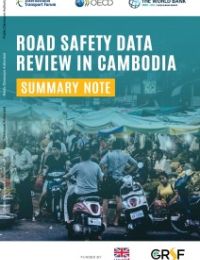
Road safety is a major public health issue in Cambodia. Reducing the number of road crashes is a priority for the government. Accurate data are needed to design the most effective interventions. Improving the current crash data system will furnish a more comprehensive picture of critical road safety issues in Cambodia and provide the basis for developing policies to save more lives.
In the framework of the development of the Asia Pacific Road Safety Observatory (APRSO), the World Bank and the International Transport Forum (ITF), with the support of the Cambodian Government, initiated a project aimed at assessing the crash data system in Cambodia and developing a road map for strengthening this system.
This project follows up on a previous twinning project between Cambodia and the Netherlands, undertaken in the framework of the International Road Traffic and Accident Database (IRTAD) group of ITF in 2010-2014. That project concerned both a review of the Road Crash and Victim Information System (RCVIS), and training and support to develop a national road safety strategy and related indicators.
The current project started in 2019 and was carried out by the World Bank and the ITF, with support from the Global Road Safety Facility (GRSF) and UK AID. The Dutch Road Safety Research Institute, SWOV, was contracted by the ITF to lead the review.
This report provides conclusions and recommendations on the basis of the data review mission undertaken in December 2019.
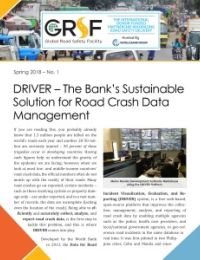
If you are reading this, you probably already know that 1.3 million people are killed on the world’s roads each year and another 20-50 million are seriously injured – 90 percent of these tragedies occur in developing countries. Having such figures help us understand the gravity of the epidemic we are facing; however, when we look at most low- and middle-income countries’ road crash data, the official numbers often do not match up with the reality of their roads.
Many road crashes go un-reported, certain incidents – such as those involving cyclists or property damage-only – are under-reported, and in a vast number of records, the data are incomplete (lacking even the location of the crash). Being able to efficiently and accurately collect, analyze, and report road crash data, is the first step to tackle this problem, and this is where DRIVER comes into play.
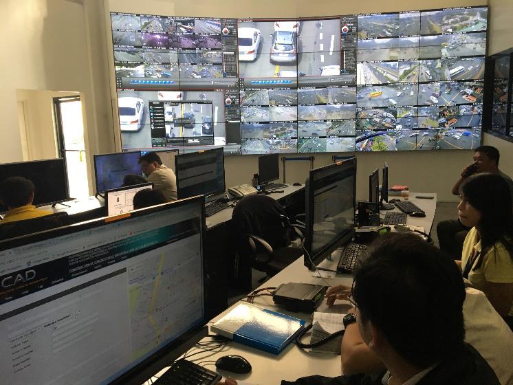
Developed by the World Bank in 2013, the Data for Road Incident Visualization, Evaluation, and Reporting (DRIVER) system, is a free web-based, open-source platform that improves the collection, management, analysis, and reporting of road crash data by enabling multiple agencies such as the police, health care providers, and local/national government agencies, to geo-reference road incidents in the same database in real time. It was first piloted in two Philippine cities, Cebu and Manila and since then, the GRSF has supported the improvement and deployment of DRIVER through workshops, pilot projects, implementation support and scaleup in countries such as Brazil, Bangladesh, India, Kazakhstan, Laos, Thailand, Vietnam, and Saudi Arabia.
